Tromsø - A Trip to the Arctic Circle
Published:June 2025
This trip to Tromsø, within the Arctic Circle, provided an opportunity to experience the environmental context behind current research in environmental DNA and palaeoecology, linking landscape, climate and scientific study.
Placing environmental DNA research in an Arctic landscape
The second meeting of the sedaDNA Scientific Society was held at the Arctic University of Norway from June 24th–25th, 2025, in Tromsø. Pre-conference workshops took place at the University Museum on June 23rd, and two post-conference excursions were held on June 26th.
We arrived on the 21st — Midsummer’s Day — along with many entrants from all over the world who were taking part in the Midnight Sun Marathon.
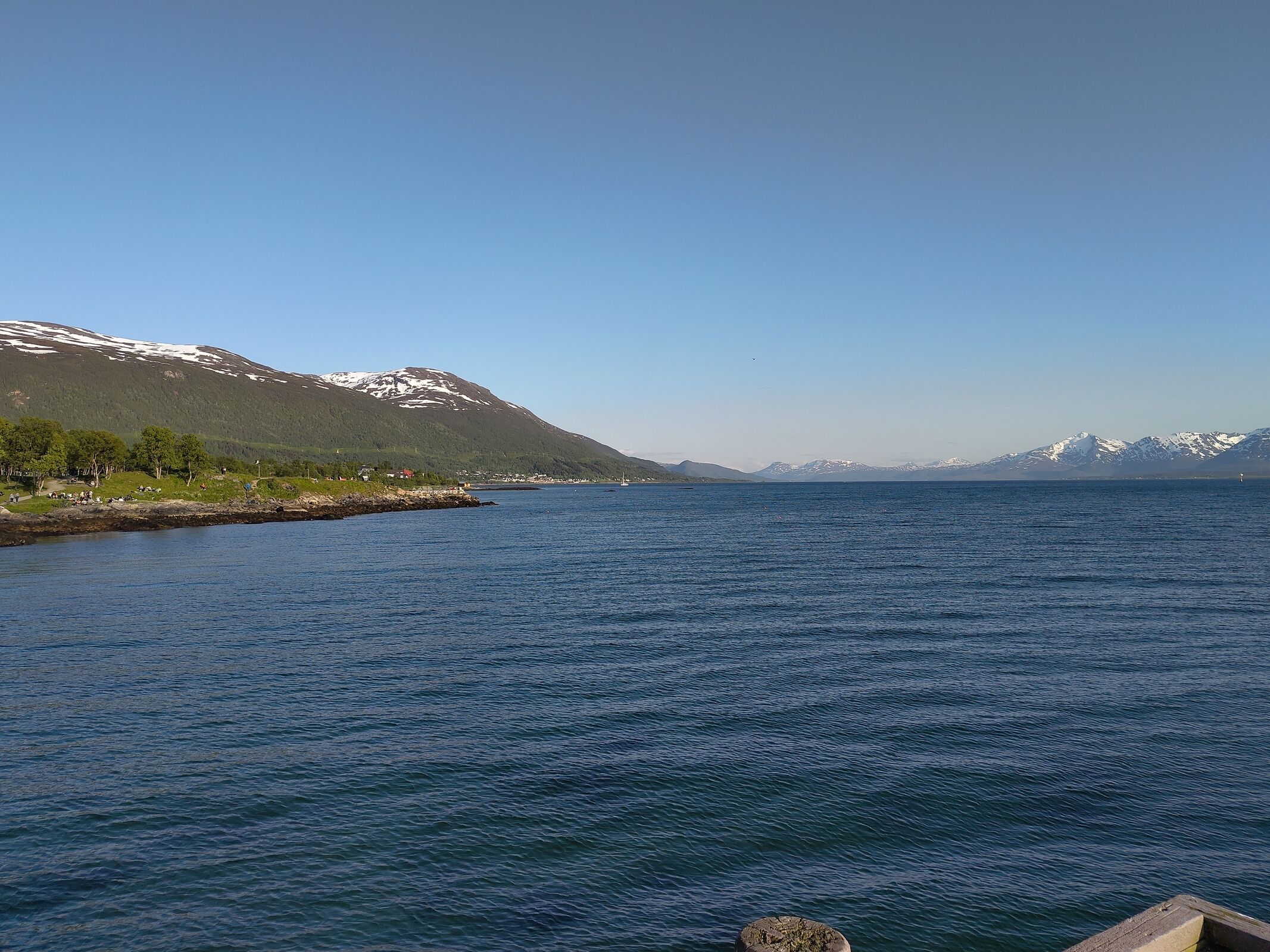
Tromsø is situated at 69° North, about 350 km north of the Arctic Circle. The city is built on an island that lies sheltered behind the larger island of Kvaløya, in the strait of Tromsøysundet — a looping branch of the Arctic Sea that winds behind the islands of Senja, Kvaløya, Ringvassøya, and Reinøya. The Norwegian coastline is deeply cut by fjords and scattered with an incredible 320,000 islands, giving the country a long and rugged edge.
The City
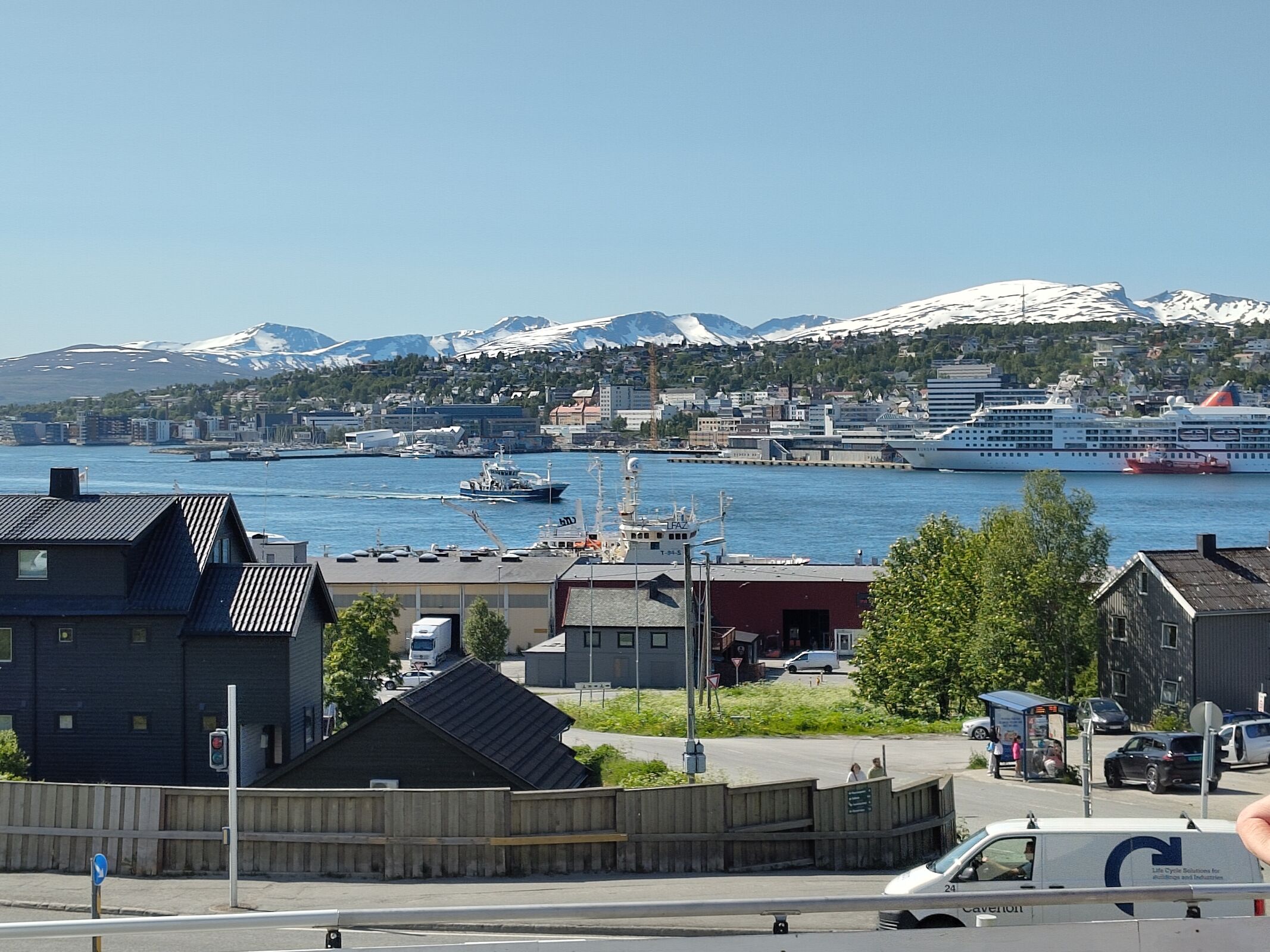
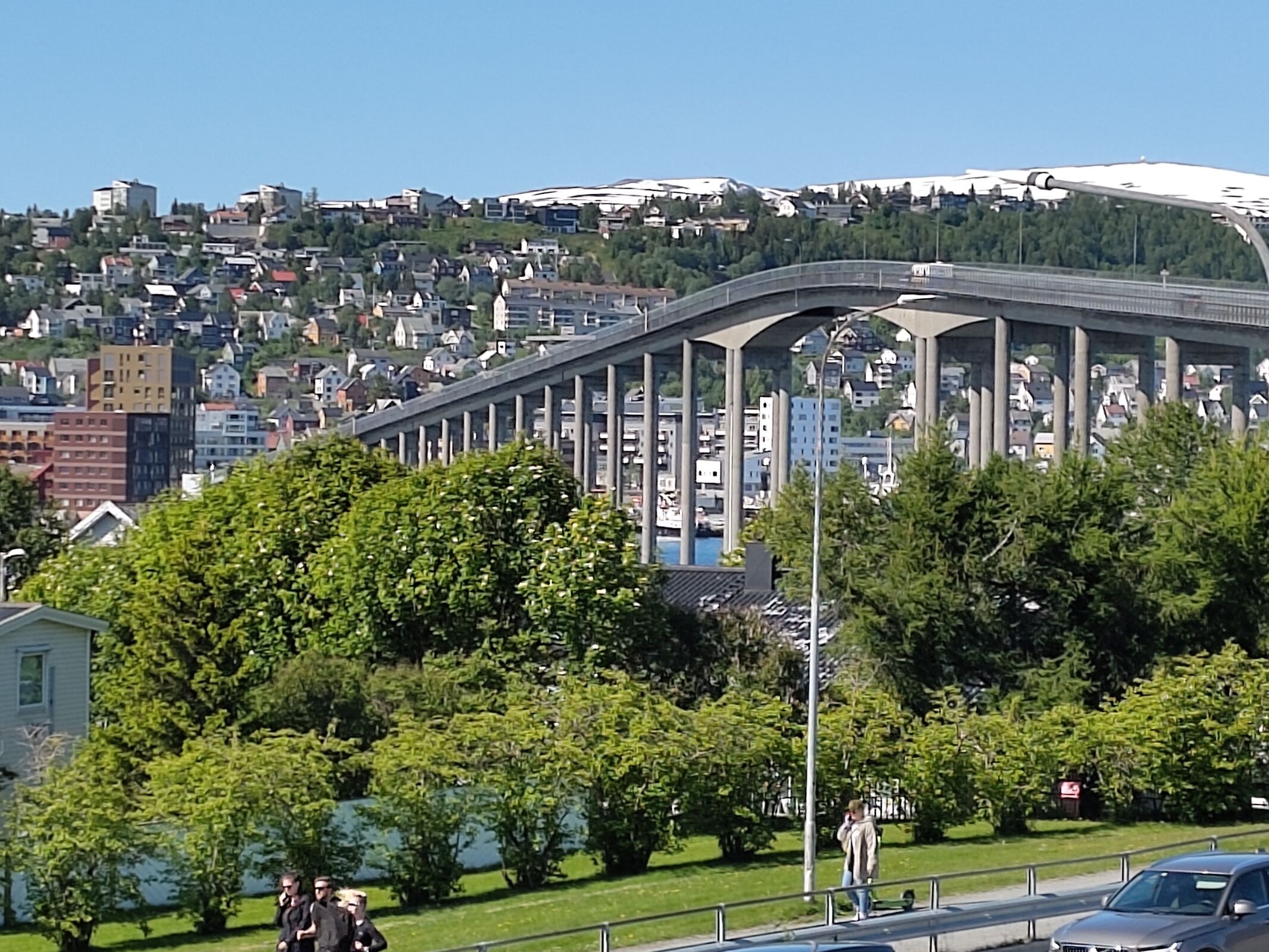
Tromsø itself is a modern city, reached from both east and west by wide, high-spanning bridges. The old Cathedral of Our Lady, built in the mid-nineteenth century, lies in the centre of the island — a wooden church of great character. In contrast, the modern triangular Arctic Cathedral stands across the bridge to the east in Tromsdalen.
We had sunshine every day — and every night — with few exceptions, and used our first two days as an opportunity to explore the city. The most striking thing was the expense of everything, largely due to the need to import goods, but also reflecting high taxation policies.
One afternoon we took a boat trip up the strait and into one of the long inlets — not strictly fjords, but still deep-water channels between forested, mountainous hills. It was sunny, warm, peaceful, clear, and clean, and when the breeze came off the land it carried an icy chill and the smell of snow. Ice still lingered on the hilltops, later than usual after a late snowfall in the spring.
The Conference
The presentations and workshops were generally interesting, though often at or beyond the limits of my understanding. Bioinformatics occupied the morning of the 23rd — the processing of data produced from DNA analysis — followed by nanopore sequencing in the afternoon.
Nanopore sequencing is not directly relevant to my project, as it relies on long strands of DNA. Sedimentary ancient DNA (sedaDNA) tends to comprise very short strands, broken over time and somewhat degraded — often only a couple of hundred bases long — whereas nanopore methods are better suited to much longer strands, sometimes thousands or even millions of bases in length. The method works by passing DNA strands through a detector, so length is critical to obtaining a readable signal.
Even so, it was fascinating. One clear theme throughout the conference was that boundaries are constantly being pushed back — new ground is continually being broken, new methods developed, tested, refined, and adopted. Sedimentary DNA analysis is a rapidly advancing field.
That evening there was an icebreaker at the museum, with plenty of food and drink. Afterwards we walked down to the Telegrafbukta beach through bright green, fresh birch woodland and brilliant sunshine. It was 10pm.
Key Presentations
On the 24th, I attended sessions on lacustrine sedaDNA and DNA taphonomy in the morning.
The afternoon began with a plenary by Eske Willerslev, which for me was the highlight of the conference. Willerslev, an evolutionary geneticist from the University of Copenhagen, focused on how ancient environmental DNA can be used to reconstruct past ecosystems and track how plants, animals, and microbes responded to climate change over long timescales.
His argument went further: these records may not just describe the past, but could help design future agricultural systems that are more climate-resilient, productive, and biodiversity-friendly. He made a strong point about the existential crisis facing humans with food insecurity, reliance on global transport and failure to manage the environment sustainably.
He also highlighted how sedimentary DNA has reshaped debates on megafaunal extinction, human migration, and ecosystem change by revealing entire communities from soil and sediment, even where fossils are scarce.
Some examples were striking — including work on the timing and sequence of human movement from Siberia into North America, and studies in Iceland showing that biodiversity actually increased following human settlement, due to the introduction of agriculture, animals, manure, and cropping.
This plenary was followed by further lacustrine DNA presentations, particularly relevant to my own project at Three Lakes.
The conference dinner that evening, held in the dockland area of Tromsø, was well attended, with excellent food, drink, and companionable conversation, ending with a long stroll home through sunlit streets at midnight.
The following day focused on computational and molecular methods, finishing with a third lacustrine sedaDNA session.
The Excursion
Thursday 26th June was excursion day. There were two options: a gentle walk to an alpine meadow (which my wife chose), and a longer, more strenuous hike to the Steindalsbreen glacier — which I was very keen to undertake.
We have excellent glacial deposits and erosion features in south-west Ireland, so I was eager to see a glacier in action. My only previous experience had been the Cook Glacier in New Zealand.
Both excursions involved a 90-minute drive south onto the mainland. The coaches split near the end of the journey.
The Glacier Hike
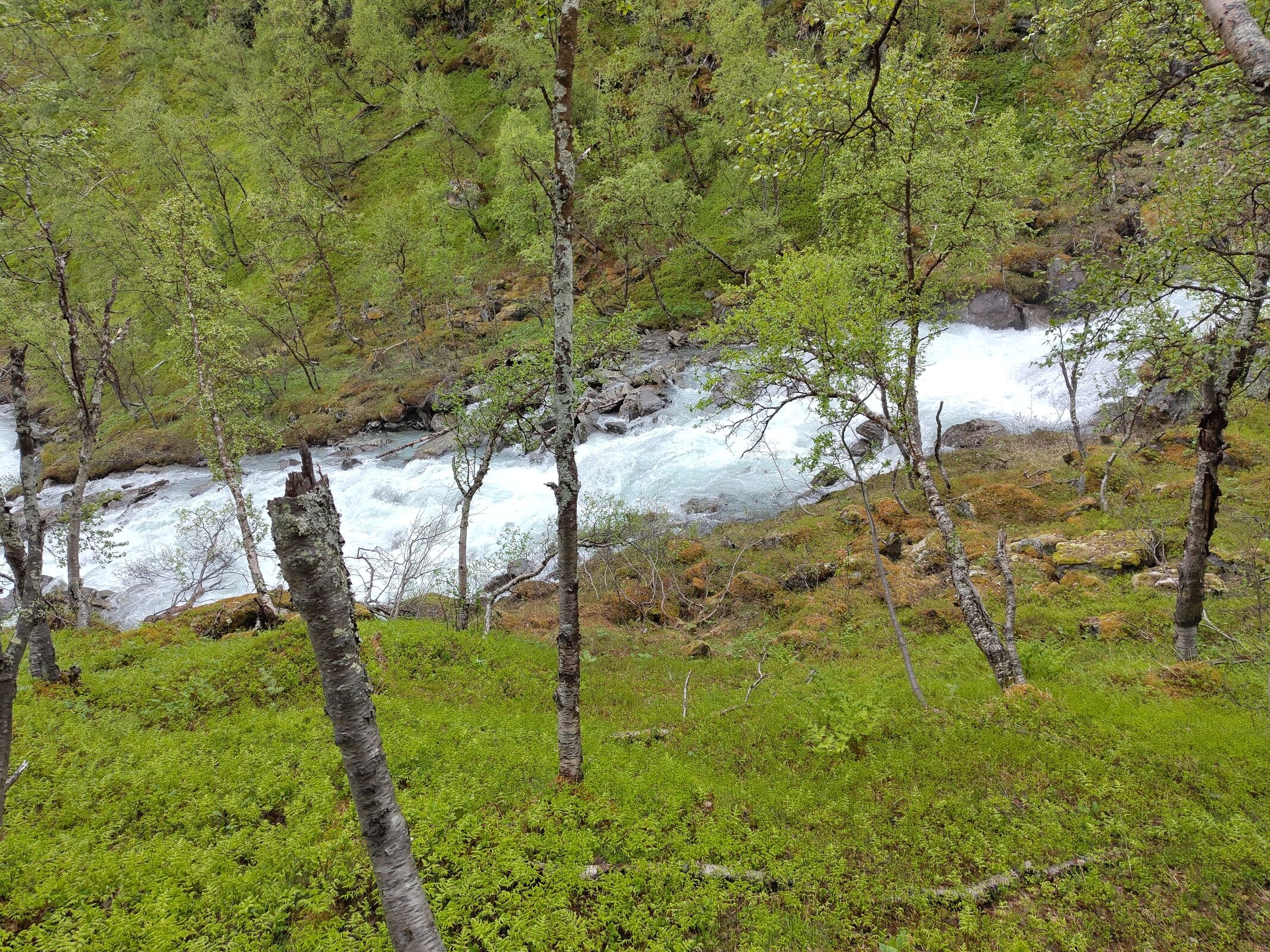
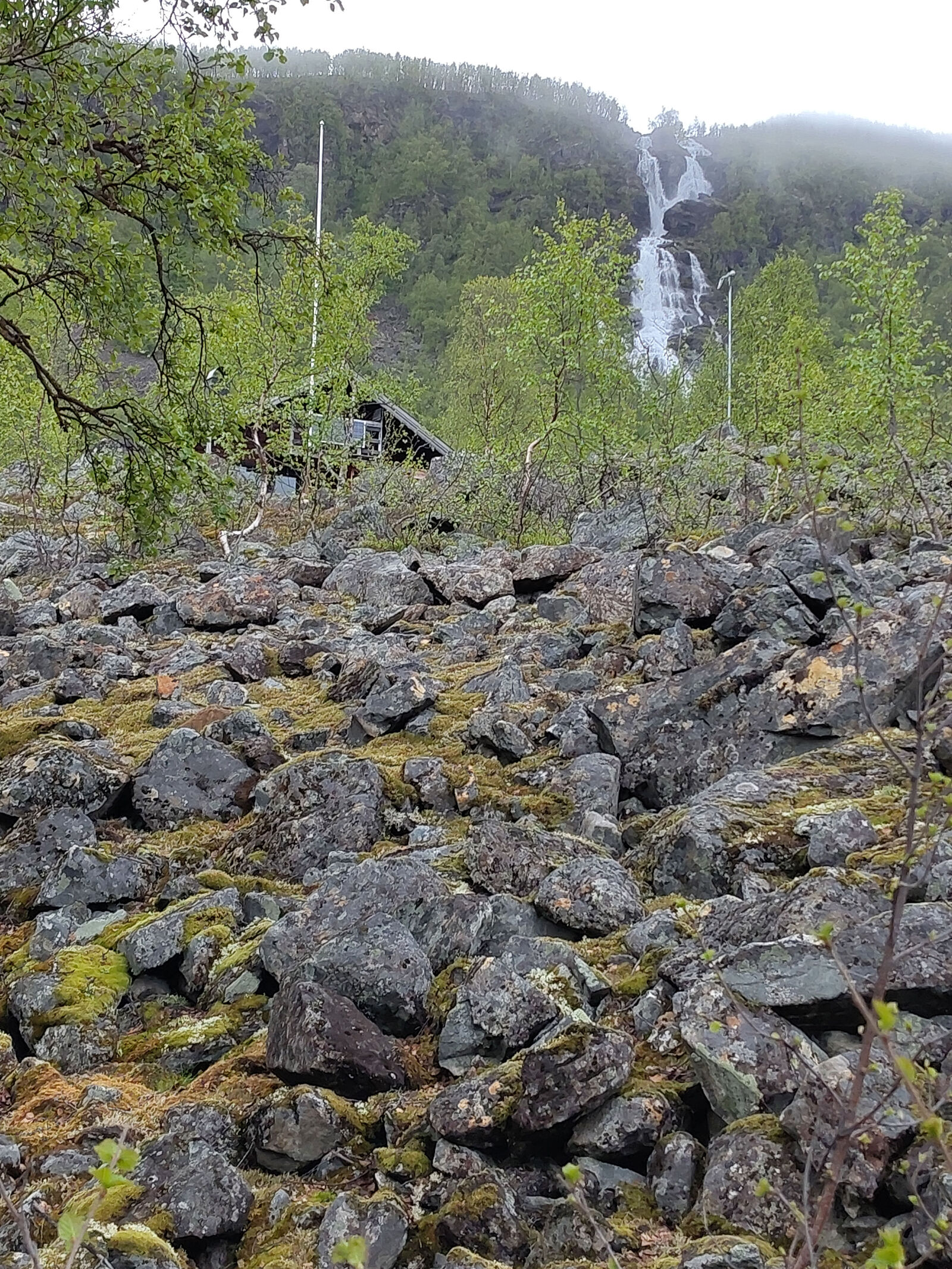
The hike to Steindalsbreen (69.4°N, 19.9°E) began in a wooded V-shaped valley, surrounded by steep hillsides, with a milky-blue river flowing energetically below. The woodland consisted of birch and alder, with high light levels allowing rich ground vegetation.
The track climbed steadily along the northern side of the valley. Along the way we saw a wide range of plant life: low-growing Cornus with creamy white flowers and dark centres, juniper bushes, and abundant berry plants — crowberry, blueberry, and cranberry. Cow-wheat, heather, brambles, ferns, and grasses formed the main ground cover.
As we climbed, the valley widened, revealing exposed rockfaces and formations shaped by recent glacial activity. We crossed several ridges marking former moraine positions. High above the valley waterfalls of meltwater poured over the edge of the high ground and tumbled down to join the Steindalsbreen river.
About two-thirds of the way up, the trees disappeared, replaced by open grassy slopes. The valley broadened into a classic U-shape, with smooth slopes rising to rocky outcrops and boulder fields.
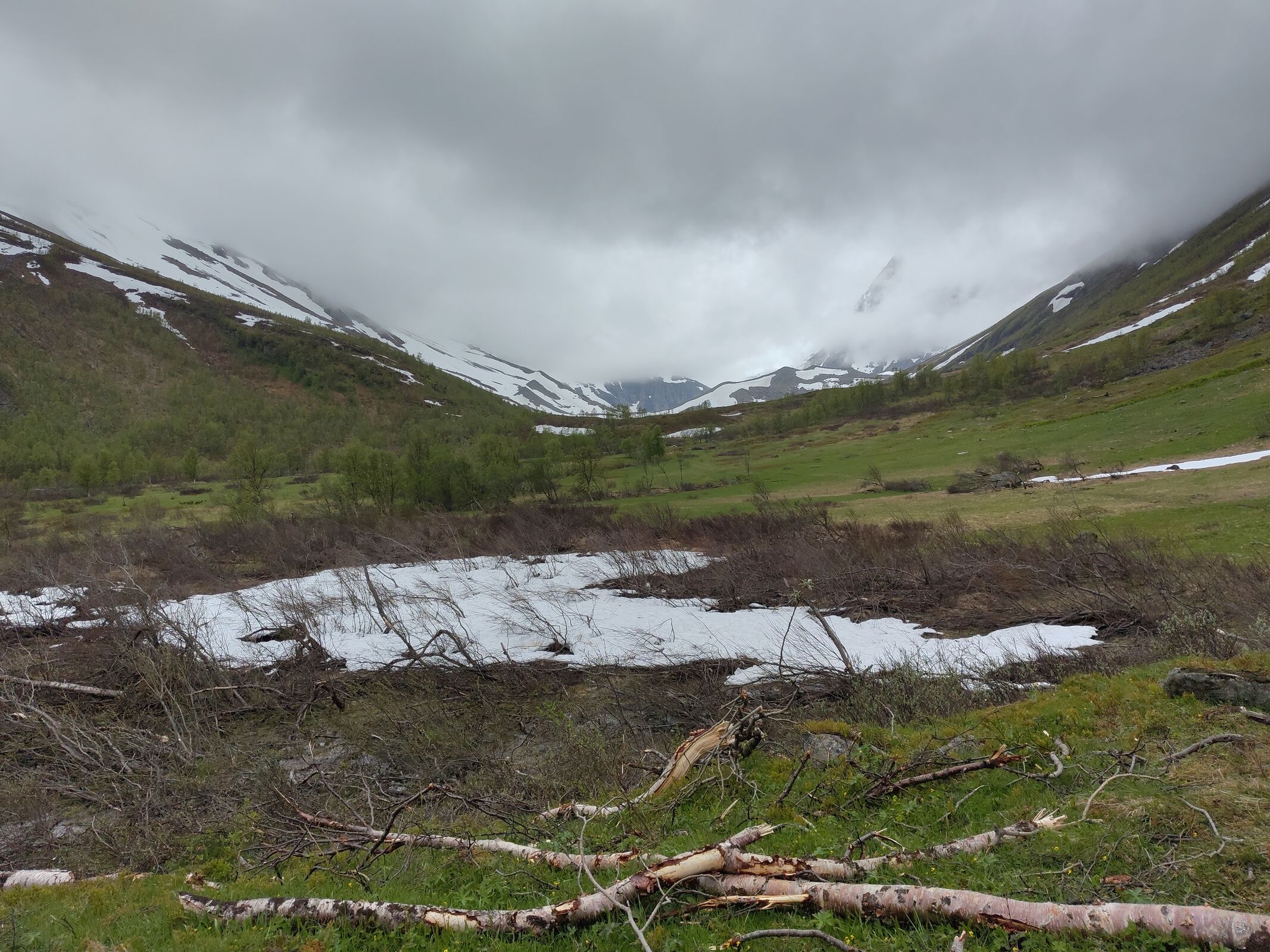
The final third of the hike was fully exposed, with sparse vegetation: stunted willow, grasses, stonecrops, and small heather. We crossed exposed rock and old ice before reaching newly exposed ground of gravel, silt, and rock.
Here we could clearly see striations on exposed rock surfaces — scratches left by the grinding passage of the glacier.
The Landscape in Motion
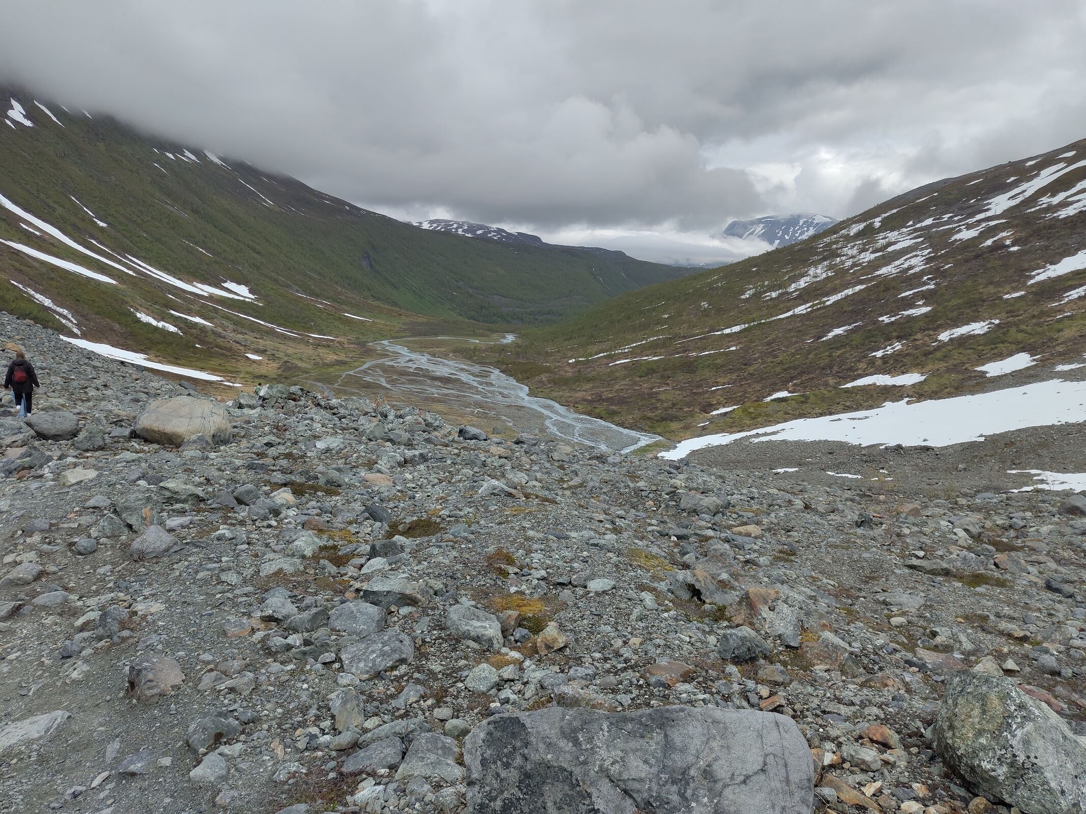
Looking down the valley, the river could be seen flowing across flats of sand and gravel, dividing, subdividing, and then converging and coalescing — forming a classic braided (anastomosing) system. This occurs where large volumes of water flow across mobile sediment, constantly reshaping the channels.
Classic.
To the north, with the sun breaking through, we could see the glacier itself — an icefall descending like a frozen river down the mountainside.
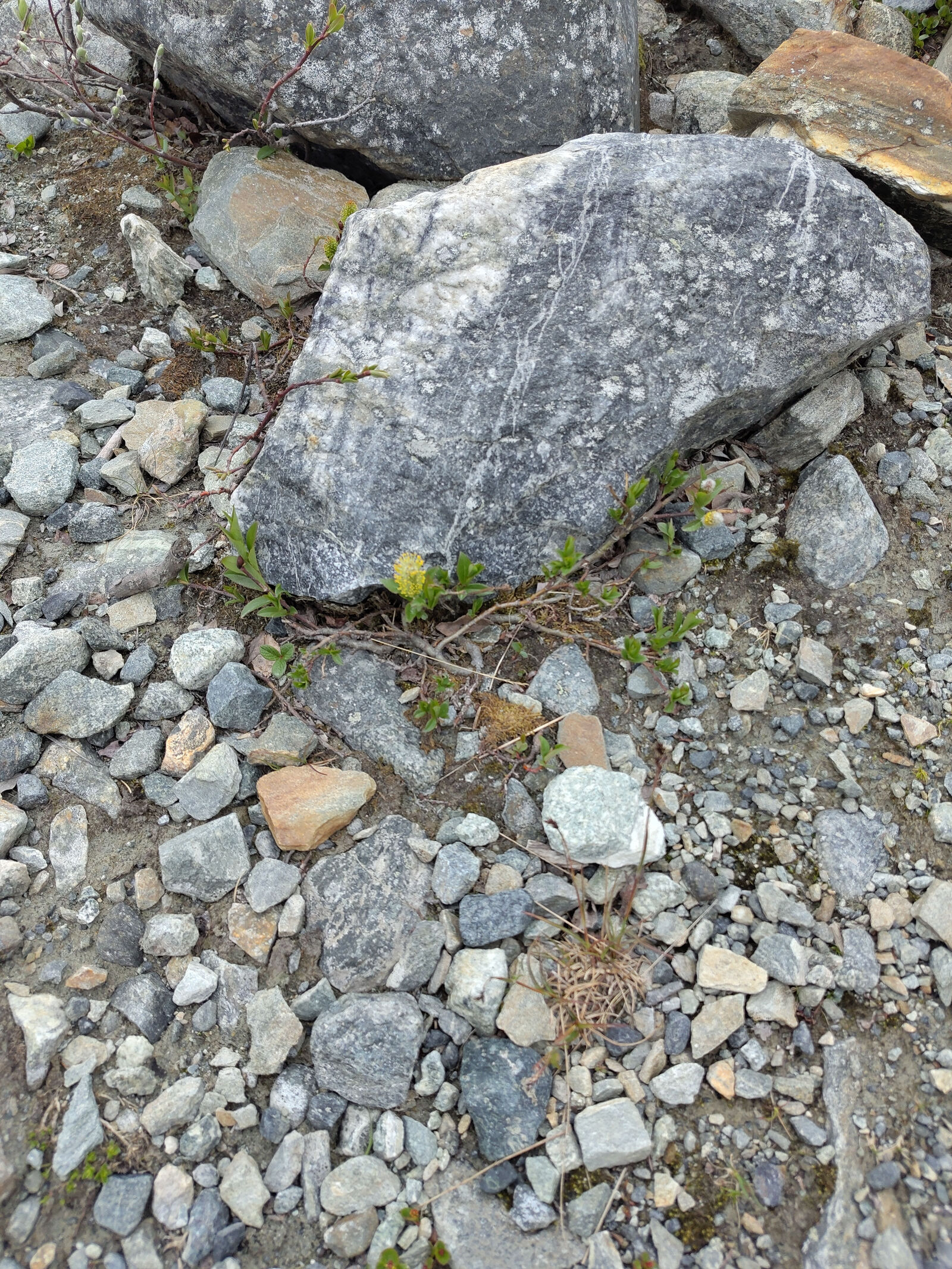
Even up here, amongst exposed and scratched bedrock and vast mounds of assorted sized gravel from silt to boulders, some vegetation managed to grow. A dwarfed willow poked out from under a rock with just one flower. A pink stonecrop, flowering brilliantly despite the inhospitable surroundings.
We still had some distance to go, crossing old ice, but our guides informed us that we could go no further. The late snowfall meant that crevasses were hidden beneath snow, and the lake ahead was covered by fragile ice. It was simply too dangerous.
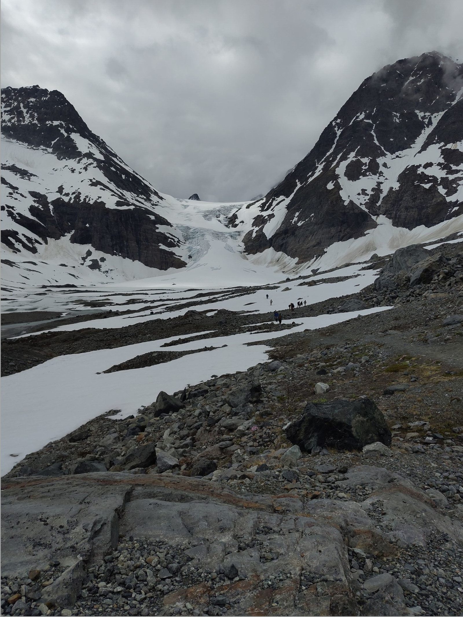
So we gathered at the highest safe point, taking photographs and absorbing the scene — the environment, the scale, and the pristine, untouched beauty.
The Return
The walk back was steady, with fewer pauses, though the return journey offered new perspectives on the landscape. Eventually we reached the final descent to the car park and the welcome comfort of the bus.
In total, the hike gained about 450 metres in elevation, and the 10–12 km journey took us from around 10 am to 4 pm.
Final Thoughts
A great day out — and one that alone would have made the entire trip to the Arctic Circle worthwhile.